Mount Seymour Snowshoe Trail – Table of Contents
- Mount Seymour Snowshoe Introduction
- Hike Statistics
- Mount Seymour Video
- Map and Elevation
- Hiking Route Description
- Directions and Parking
- Free PDF Download
Mt. Seymour (Pump Peak) Snowshoe Intro
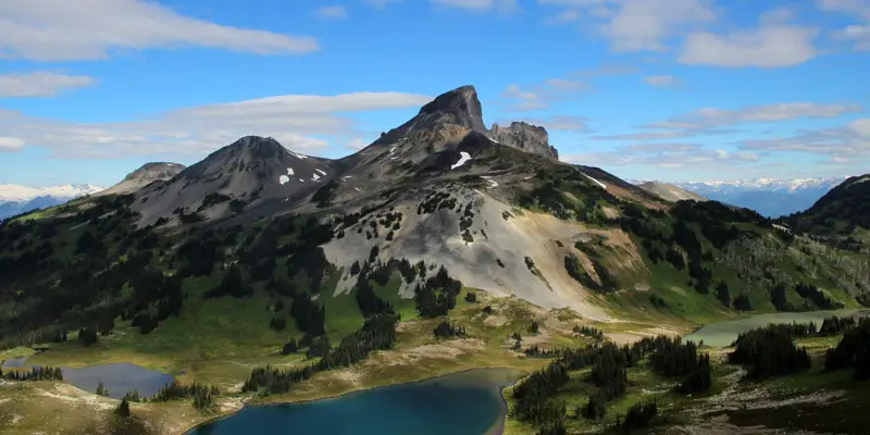
The winter route to Pump Peak on Mount Seymour is a popular snowshoe trail on the North Shore. The snowshoe route is marked by B.C. Parks and is a nice alternative to the snowshoe trail to Dog Mountain for those looking for a more challenging hike.
Heading up to Pump Peak is longer than the Dog Mountain snowshoe, and also has significantly more elevation gain. If you’re new to snowshoeing, Dog Mountain is a better starting point.
The route is marked by poles all the way to Pump Peak, the southernmost of Seymour’s three main summits. The Seymour snowshoe route doesn’t go all the way to the true, northernmost summit of Mount Seymour. Some people do carry on all the way, but traveling beyond Pump Peak has significantly more hazards and avalanche risk. As such, it is not advised except for experienced travelers who have avalanche safety training.
Snowshoeing the Pump Peak Trail provides incredible views and a solid workout. From the summit, on a clear day, you look down over the Lower Mainland and Fraser Valley as far as the eye can see.
The route to Pump Peak is maintained by B.C. Parks and is free-to-use. Mount Seymour Resort has its own snowshoeing trails you can use, for a fee.
Avalanche Awareness
Avalanche.ca rates this route as Class 2 (Challenging) terrain: “Exposure to well defined avalanche paths, starting zones or terrain traps; options exist to reduce or eliminate exposure with careful routefinding. Glacier travel is straightforward but crevasse hazard may exist”. Use the Avalanche.ca Trip Planner to factor in the risk levels with current avalanche forecasts. More information about winter travel and avalanche safety can be read here.
Pump Peak Snowshoe Stats
Rating: Moderate
Distance: 7 km
Net Elevation Change*: 373 m
Highest Point: 1392 m
Time Needed: 4 Hours
Type: Out-and-back
Season: Year-round
Dogs Allowed: Yes, on leash
Est. Driving Time from Vancouver: 30 Minutes
Trailhead Coordinates: 49.367516 -122.94921
Mount Seymour Video
Here is a 2-minute video of our experience on this hike!
Mt. Seymour Snowshoe Hike Map and Elevation
Mount Seymour
Profile
Pump Peak Trail Snowshoe Route
The trailhead is found at the northernmost end of the parking lot, near the base of the Mystery Peak Express chairlift. There is a B.C. Parks map and information board at the end of the parking lot.
Follow the trail to the left of the ski run and chairlift. Immediately up the trail, there is a junction marked for First Lake Loop Trail – that is the way to Dog Mountain. Keep going straight in the direction marked for “First Pump Peak (7 km return)”.
Following the trail should be easy enough. Unless you’re one of the first travelers after a fresh snowfall, there should be plenty of tracks in the snow. The trail is heavily used so if there has been no recent snow it should be wide and compact. If this is the case, snowshoes probably aren’t necessary and you’ll be better off with good winter boots and MICROSpikes/ Hillsound Trail Crampons.
There are also poles every 20 yards or so marking the way. They will either be bamboo with orange tips, or orange plastic poles.
The trail is wide and begins climbing uphill immediately. The trail will continue to climb, with few flat or downhill sections, until you reach the summit.
After about 10 minutes, or 700 m, there will be a little junction for a trail that veers off to the left. Keep going straight.
After about 15 minutes you’ll see the ski run again on your right. There’s a sharp but short climb and you’ll come out to the edge of the ski run itself. This is about 1.1 km into the hike.
As you crest the hill, you’ll see the lower ridge of First Pump Peak up ahead of you.

You will come to a lookout on the left where you can see Suicide Bluff down below, and Crown, Fromme, and Grouse mountains across the Seymour Valley to the west.
From here, the trail will drop down briefly and then carry back up. Over the next few hundred meters, the trail will roll up and down several times.
As you continue to gain net elevation, an incredible view of Vancouver opens up behind you.
After about 50 minutes, or 2.5 km, you’ll start to head east. The top of Brockton Chairlift will be clearly visible down to your right. This is Brockton Point and has nice views in all directions.


The trail will drop down sharply here for a short way.
After about 1 hour or 3 km, you’ll come to the junction for Elsay Lake. That trail is closed in the winter due to severe avalanche risk. Stay well back from the ropes and ‘Danger!’ sign. Follow the poles and the markers in the trees.
From here, the steepest part of the hike is ahead.
As you continue climbing up, you’ll have sweeping views east, towards Golden Ears. You’ll reach a lookout that provides an incredible view in that direction.


The trail will hook back around left, heading west, towards Pump Peak.
As you head west, you can see the summit directly ahead of you in the distance. The trail has one final steep climb before reaching the end of the marked winter route. There will be a sign indicating it is the end of the marked route and traveling any further is hazardous.
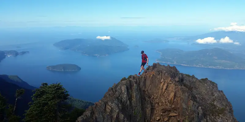
From the summit of Pump Peak you can see Vancouver, Stanley Park, the Burrard Inlet, Mount Baker, and all of the Lower Mainland to the south. To the north, you can see Tim Jones Peak (the second of Seymour’s three summits). To the east, you can see and endless sea of mountains towards Golden Ears, and to the west you can see Grouse and Fromme mountains, among many others.
Enjoy the incredible views before heading back by the same route.
Download the PDF version of this guide for offline use


Directions and Parking
Drive east on Highway #1 over the Iron Workers Memorial Bridge. Take exit #22 for Mt. Seymour Parkway and follow it for about 10 minutes until you see the signs for Mount Seymour Provincial Park. Here, you turn left at Mt. Seymour Road and follow the road all the way up the to Seymour parking lot. The trailhead is at the northern-most point of the lot.
The park gate is closed from 10 pm – 7 am during the winter until April 30th. The road to Mt Seymour is a Class A Highway and requires drivers to use winter tires or carry chains between October 1st – April 30th.
Winter parking designations are in effect from November to April. On peak days during the winter months, parking capacity can be exceeded at the upper parking lots of Mount Seymour Park. These parking lots service the customers of Mount Seymour Resorts Ltd., who pay a fee to ski, snowboard, snowshoe and snowtube. Visitors accessing the backcountry, areas outside of the Mt. Seymour Resorts Ltd. ski area are required to park in parking lot 1 and lower parking lot 5. Overnight parking is permitted in parking lot 1.1
A map of the parking lots is here. Google Map directions are available here.
Other great snowshoe trails in this area
- Dog Mountain (easy)
- The Snowshoe Grind (moderate)
- Hollyburn Mountain (moderate)
- View all hiking guides here
Download the PDF version of this guide for offline use