Mount Fromme – Table of Contents
- Hike Introduction
- Hike Statistics
- Mount Fromme Video
- Map and Elevation
- Hiking Route Description
- Directions and Parking
- Free PDF Download
Mount Fromme Hike Intro
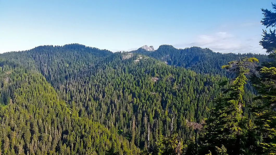
Mount Fromme sits just east of Grouse Mountain and is home to a large number of mountain biking and hiking trails. At an elevation of 1,185 m, the view from the summit of Mount Fromme is rewarding, but is by no means the best around. Mount Fromme offers views of Lynn Ridge, Coliseum Mountain, Mount Burwell, and Mount Seymour.
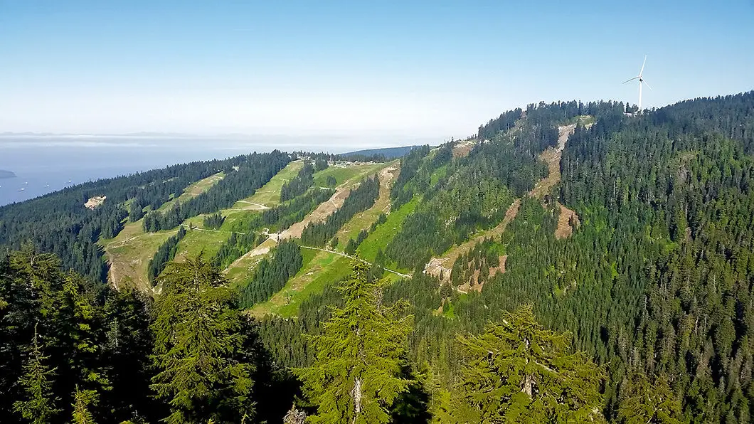
Close to the summit of Mount Fromme is another peak – Senate Peak – which also offers partially obstructed, yet beautiful views. Senate Peak overlooks Grouse Mountain and the Burrard Inlet.
The hike to Mount Fromme is worth the effort. The views are good, the trails up are enjoyable, and the trail sees less traffic than other nearby hikes.
Mount Fromme Hike Stats
Rating: Moderate
Distance: 11 km
Net Elevation Change*: 850 m
Highest Point: 1,185 m
Time Needed: 5 Hours
Type: Out-and-back
Season: June to October
Dogs allowed: Yes
Est. Driving Time from Vancouver: 30 Minutes
Trailhead Coordinates: 49.347429, -123.065940
*For a better understanding of the stats and difficulty rating, check out the Hiking Guides page for details. Always carry The Essentials and fill out a trip plan.
Mount Fromme Video
Here is a 2-minute video of our experience on this hike!
Mount Fromme Hike Map and Elevation
Mount Fromme
Profile
Mount Fromme Trails
There are several possible starting points for the hike to Mount Fromme. This guide starts at the St. Mary’s Trail at the end of St. Mary’s street in North Vancouver. Another regularly used access point is at the end of St. Georges Street. It is also possible to start at the top of Grouse Mountain and access Mount Fromme via Old Mountain Highway, or via the Thunderbird Ridge and Erik the Red trails.
There are countless mountain biking trails on Fromme. For this reason there is no single way to get up to the summit of Fromme from the bottom. It also makes for many junctions, and opportunities to get off track. If you are not familiar with the trails on the bottom of Mount Fromme, it can be confusing trying to stay on the route. At many points, a single trail will briefly split into two, before merging again. It is a good idea to study the route for the hike to Mount Fromme and have a map handy. A GPS device may be helpful if you are not familiar with the trails.
For this guide, we will be taking three main trails to get to the Mount Fromme summit: Dreamweaver > Executioner > Per Gynt. Along the way, two key landmarks are crossing over the Baden-Powell Trail, and meeting Old Mountain Highway twice.
The good news is the mountain biking community does an amazing job of maintaining these trails and they are very well marked.
As many of trails are shared-use, you’ll want to be ready for mountain bikers zooming down the mountain. If you hear mountain bikers coming, step off the trail and give them plenty of room (you will not win a head-to-head collision with a well-armored rider). Often, the lead rider will tell you how many other mountain bikers you can expect behind him or her in their group (ie, they’ll yell ‘two more!’ or ‘three more!’). Stay aside until the group passes and carry on.

Mount Fromme Hiking Route
Park on St. Mary’s Street and you will see the trailhead on the side of the road. Starting at the St. Mary’s trailhead, within a few minutes you will pass under the power line and cross over Power Line Trail. You will enter the dense forest of Mount Fromme and quickly find a marked junction. Stay along St. Mary’s Trail. Carry along the trail a few minutes further and you will come to another junction for Boundary Trail and Dreamweaver (it will be marked ‘climbing route’). Go left here, and generally speaking, you’ll want to follow any of the signs marked ‘climbing route’ along the hike.
You’ll soon come to another junction at a wide double-track trail. Stay in the direction marked for Dreamweaver, which is directly straight ahead on the other side of the wide trail.
Moving along Dreamweaver trail, you will come to a bridge with wooden ‘Dreamweaver’ sign hanging from a tree. Stay along this trail until you reach a junction for Executioner trail, around 1.9 km into the hike. Here you will switch-back onto Executioner trail. The trail here becomes steep and technical. The trail climbs, switchbacks once, and within 1 km you will reach Old Mountain Highway – a large dirt road – and you will go left onto the road.
At the switchback in the corner of the road, you will see a 4×4 wood post with a ribbon tied around it and the words ‘Per Gynt’ written in felt marker. At this marker go right, heading uphill. It is flagged here as being at 710 m elevation. Per Gynt Trail will take you the rest of the way to the summit of Mount Fromme. The trail is marked with orange markers and orange flagging. Per Gynt is a fairly difficult trail, but it is easy to follow without going astray from this point.

Hike another 600 m until you once again intersect Old Mountain Highway at 3.5 km. Walk almost directly straight across Old Mountain Highway and you will see Per Gynt trail off to the side of the road, marked with ribbon. Once you’re here, it’s basically a straight shot to the summit. The trail is less technical and much flatter – however you have a solid 2 km of hiking.
Follow the trail through the forest, and as you begin to approach the summit it will begin to climb upwards again. You will reach one final junction, and go right here. The summit is just a few minutes away.
At the summit, you can see The Needles and Lynn Ridge, Coliseum Mountain, and Mount Seymour and Mount Elsay off to the east. To the north, through an opening in the trees, you can also see Crown Mountain.
To the north, you will also find another trail that drops downward. This will take you to nearby Senate Peak, which is worth the 15 minute (each way) detour. From Senate Peak you can see Grouse Mountain and get a great view of Crown Mountain. It is also possible to do a loop between Senate Peak and Mount Fromme down to a tarn, or just return the way you came from.
Once you’re back at Mount Fromme and all rested, retrace your steps back down to your car.
Download the PDF version of this guide for offline use

Driving Directions and Parking
From the Upper Levels Highway (Highway #1), exit at Lonsdale heading north. Drive up Lonsdale for a few minutes and take a left on Braemar Street. Take a left of St. Georges, a right on Balmoral, and a left on St. Mary’s. The trailhead is up the street on your right-hand side.
Google map directions are here.
Other great hikes in this Area
- Kennedy Falls (moderate)
- Norvan Falls (moderate)
- Goat Mountain (moderate)
- View all hiking guides here


Leave a Reply