Mystery Lake Hike on Mount Seymour

Mystery Lake Hike Stats
- Rating
Difficult hikes offer big climbs with lots of elevation gain and technical terrain, some requiring a full day’s effort. Generally, difficult hikes should not be undertaken by children or novice hikers. These are rated as ‘hikes’ and not ‘walks’ so even something rated as easy may have a few sections of challenging terrain.
More on how we measure trails - Easy
- Distance
For the out-and-back hikes, the distances offered for each hike are measured from the trailhead, to the summit, and then back to the trailhead. Distances, even when provided to a fraction of a kilometer, are only rough estimates.
More on how we measure trails - 3 km
- Net Elevation Change
The listed elevation gain is the simple math of the difference in the starting elevation and the summit, in meters. It is not a cumulative calculation of the total elevation gained during the hike. This means, in most cases, you will actually climb more than the listed net elevation gain.
More on how we measure trails - 140 m
- Highest Point
- 1,160 m
- Time Needed
The completion times of the hikes are estimates and will, naturally, vary per individual, ability, and weather conditions. The times offered, however, are meant to be generous.
More on how we measure trails - 1.5 Hours
- Type
- Out-and-back
- Season
Each hike has a corresponding season when the trail is most likely to be in good condition. However, as the snowmelt can vary each year, these too, are estimates. It is best to confirm the current trail conditions before heading out.
More on how we measure trails - July to October
- Dogs Allowed
If hiking with dogs is allowed, it does not necessarily mean that the trail is ‘dog-friendly’. Even though dogs might be allowed, it may be a bad idea to bring them on certain Vancouver hikes (due to ladders, difficult sections, boulder fields, etc).
More on how we measure trails - Yes, on leash
- Est. Driving Time from Vancouver
- 30 Minutes
- Trailhead Coordinates
- 49.367578, -122.949108
*For a better understanding of the stats and difficulty rating, check out the Hiking Guides page for details. Always carry The Essentials and fill out a trip plan.
Usually in season as shown; check current conditions before you go.
Mystery Lake Hike Intro
Located on Mount Seymour in North Vancouver, Mystery Lake is one of the best summertime swimming holes around. Mystery Lake is a scenic spot, easily accessible, and a worthy destination even if you prefer to stay dry. The shore around the lake is great for relaxing and having a picnic.
The hike to Mystery Lake is comparable to nearby Dog Mountain in difficulty. The short distance is made up for by an uphill climb over the challenging and technical terrain. You’ll still feel you’ve had a solid workout by the time you have finished the hike. The trail is easy to follow all the way to the lake and takes about 45 minutes, each way.
If you’re hiking in the hot summer months, remember to bring a towel. Mystery Lake is chilly but manageable for a swim.
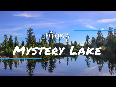
Mystery Lake Video
Mystery Lake Hike Map and Elevation
Map and elevation profile
The listed elevation gain is the simple math of the difference in the starting elevation and the summit, in meters. It is not a cumulative calculation of the total elevation gained during the hike. This means, in most cases, you will actually climb more than the listed net elevation gain.
More on how we measure trailsMap loads as it approaches the screen.
Mystery Lake Hiking Route
The trail begins from the main parking lot at the top of Mount Seymour. There is a restroom beside the parking lot you can use before beginning the hike. The trailhead itself is at the northernmost end of the Mount Seymour parking lot. You will find a signboard/map at the far end of the lot. From the Mount Seymour Provincial Park map, walk down the gravel road towards the Mystery Peak Express chairlift.
On your left will be the trailhead for Dog Mountain, and on your right will be the trailhead for Mystery Lake. Both trails are marked with green Mount Seymour Park posts. Go right, in the direction marked for Mystery Lake.
You will walk underneath the Mystery Peak Express chairlift and onto a narrow trail. The trail is immediately rooty and rocky and begins climbing uphill. The trail remains like this the whole way to Mystery Lake. The good news is that the route to Mystery Lake is a short hike.
You will see orange markers on the trees to guide you along the way. Overall, the route is easy to follow and staying on track won’t be difficult.

About 700 m into the hike you will come to a small pond on your right with a wooden boardwalk. Shortly after the little pond, you will cut across one of the ski runs. From the ski run, you will get a glimpse beyond the forest to the city of Vancouver, far below.
Keep following the trail, and soon enough you will come to Mystery Lake. The trail goes all around the lake so you can find a nice, unoccupied spot to stretch out.
At the lake, you can enjoy the beautiful scenery, and taking a swim on a hot summer day is encouraged.

There are signs that this is a sensitive amphibian breeding area. Be sure to stay on the established trail and out of marshy areas.
The Mystery Lake Trail actually continues up north around the backside of the lake. The trail continues to the top of the Mystery Peak Express chairlift. You can go that way to loop back to the parking lot. But, it’s easier and more scenic to return on the same route that you came from.

A small pond on the way to Mystery Lake.
Directions and Parking
Get directions to the trailhead
Take the Mount Seymour exit off Highway #1 in North Vancouver. Take Mount Seymour Parkway until you come to sign for Mount Seymour Road. Take a left onto Mount Seymour Road and follow it up to the ski hill area. Park your car at the northern end of the top parking lot.
Google Map directions are here.
Other great hikes in this area
 Moderate
Mount Seymour Trail
North Vancouver · North Shore
- km
- 9
- gain m
- 450
- hours
- 5
- drive
- 30m
 Difficult
Mount Elsay
North Vancouver · North Shore
- km
- 15
- gain m
- 420
- hours
- 9
- drive
- 30m
 Moderate
Dog Mountain
North Vancouver · North Shore
- km
- 5
- gain m
- 34
- hours
- 2
- drive
- 30m
 Easy
Cypress Falls
West Vancouver · North Shore
- km
- 3
- gain m
- 300
- hours
- 1.5
- drive
- 30m
More like Mystery Lake
See all 44 North Shore trails in the Finder → Easy
Lighthouse Park
West Vancouver · North Shore
- km
- 3
- gain m
- 0
- hours
- 2
- drive
- 30m
